Texas Observer: Fanning the Flames
by Christopher Collins | Mon, Aug 21, 2017
The same conservation efforts that saved Texas from the Dust Bowl may have opened the door to a new man-made disaster.
At just past 8 p.m. on April 19, a PowerPoint presentation on the basics of firefighting is concluded inside the Briscoe Volunteer Fire Department, and the 10 men gathered around a U-shaped Formica table are discussing the merits of cooking and eating the lesser prairie chicken.
“I heard it tastes just like chicken,” says Ben Pigg, a stocky, energetic man in his mid-30s. He leans back in a plastic chair, balancing precariously.
“Nah, I’ve had it before,” says Terry Tipps, who wears a full gray beard and is older than most of the other firefighters in the room. “It’s dark meat. Tastes real gamey.”
This elicits a peal of laughter from the other men, a rough-hewn bunch who work as farmers and mechanics when they’re not fighting fires. They respond to wildfire calls “whenever we get the chance,” said Pigg, and lately the calls have been serious. On March 6, they battled one of the worst wildfires ever recorded in the Texas Panhandle. Four people died in the massive blazes that engulfed 500,000 acres. The fires made state and national headlines for a day or two. The Briscoe firefighters, based at the northern tip of Wheeler County near the Texas-Oklahoma border, fought the flames for 27 hours straight. Many of them were also here for the million-acre blaze that ravaged the Panhandle in 2006, killing 12. A shadow box with photos of that fire hangs on the room’s east wall, bearing the caption: “The Day Hell Walked on Earth and the Devil Played His Song.”
The Panhandle’s dry, windy conditions lend themselves to wildfires. There’s a lot of fuel here, too — mostly prairie grasses, shinnery oak, plum thickets, cottonwoods and invasive trees — a problem that some firefighters, farmers, ranchers and experts say is exacerbated by a U.S. Department of Agriculture (USDA) program that contracts with landowners to return land to its natural prairie state. The most popular type of agreement is part of the Conservation Reserve Program (CRP), in which the agency pays landowners by the acre for not cultivating farmland in an attempt to prevent soil erosion and increase biodiversity. Essentially, the government pays farmers not to farm — to “retire” the land and provide a habitat for threatened species.
Retiring land isn’t as simple as it sounds, though. The program is essential to the region’s ecological well-being, but simply abandoning land to grow wild turns it into a tinderbox. Unless CRP land is carefully managed by mowing weeds, removing invasive trees and occasionally cutting or burning native grasses, plant growth can become tall and matted. Species such as mesquite and juniper start aggressively expanding, and plots begin to take the form of an impenetrable prairie jungle. This is where wildfires thrive.
“In the long term, it turns into a tinderbox waiting to ignite, especially when we have major wildfire conditions.”
Though some type of brush management is stipulated in most CRP contracts, an Observer investigation found that USDA enforcement has been lax. And in some cases, the feds have placed restrictions — such as on the frequency of mowing and grazing in counties designated as “intact habitats” of the lesser prairie chicken — that make controlling fire-prone vegetation difficult. That’s why the rare bird, despite having little to do with wildfires, was invoked by the firemen: To them, it represents the well-meaning but sometimes misguided efforts of the federal government to intervene on nature’s behalf. But at the same time, the firefighters and others interviewed for this story emphasized the importance of the CRP and its predecessors, which played a pivotal role in pulling residents out of the Dust Bowl. Conservation programs just need to be regulated less haphazardly, they said.
“A lot of this stuff around here went into the CRP program and you can’t do nothin’ with it. It’s been growing six or eight years,” Pigg said. Firefighter Jimmy Nelson agreed. “It gets put in that program and it just sits there.” Darren Hefley reminded the others why area farmers participate in the CRP in the first place: “It’s for the wildlife, and for fertility, to let the grass re-establish itself,” he said. “The downside of that is there’s nothing to keep it under control.”
After the March wildfires, the USDA temporarily released some CRP land for emergency cattle grazing, as significant portions of area pastures had been burned. But the fact that overgrown CRP land may have played a role in the fires was ignored, Hefley said. “The true irony is that the CRP was a contributing factor in the wildfires, and only after the fires do they turn it loose for grazing,” he said. “That’s kind of like shutting the barn door after all the cows have gotten out.”
On April 18, firefighters with the Mobeetie Volunteer Fire Department voiced similar concerns as they conducted a controlled burn on a sprawling ranch. “Nine times out of 10, whenever we have a fire, it’s burning on somebody’s CRP grass. That’s where it starts, and when it catches, it’s a big mess,” said Kevin Chesher. “There’s land around here that’s been in the program for 21 years. There’s places got damn trees on ’em 7 or 8 feet tall. Thousands of trees. And no one’s telling them to clean it up.”

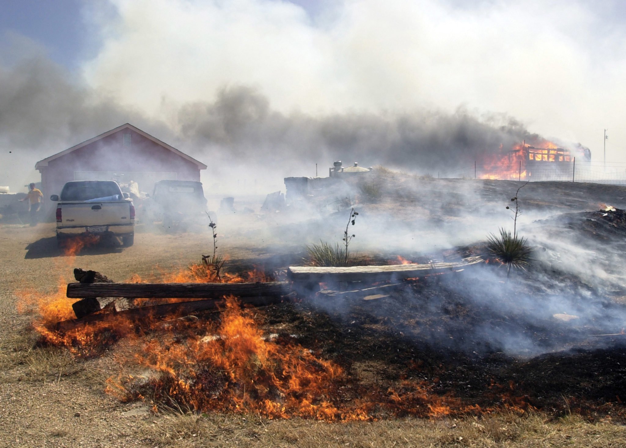
Restrictions on the frequency of mowing and grazing in designated “intact habitats” of the lesser prairie chicken have made controlling fire-prone vegetation difficult. U.S. Fish and Wildlife Service
The morning of April 14, 1935, was clear and calm in the Texas Panhandle. It was Palm Sunday, and people took advantage of the weather to hang up laundry, go to church and even picnic. But by midafternoon, the temperature had plummeted. A midnight-black cloud of dust, more than 1,000 miles long and traveling at 100 mph, loomed on the horizon. By 7 p.m., the plains were engulfed in darkness. The folksinger Woody Guthrie, 22 at the time, was at home in Pampa, northeast of Amarillo. “You couldn’t see your hand before your face,” he said later. Guthrie rode out the storm with a group of neighbors, huddled together in a small room. “A lot of people in the crowd that was religious-minded … they said, well, boys, girls, friends and relatives, this is the end,” he remembered.
Known as Black Sunday, the day saw the single biggest storm of the Dust Bowl, one of the worst environmental disasters of the 20th century. Brought on by overplowing farmland, the relentless storms left 500,000 people in the Plains states homeless. But farmers weren’t solely to blame. Through the Enlarged Homestead Act of 1909, the U.S. government enticed settlers to move west to the Great Plains, where rich soil could support bumper crops of wheat. Soon after, during World War I, German forces blocked Russian wheat shipments from reaching the United States, driving up the crop’s price domestically. Plains farmers cashed in by plowing millions of acres of virgin soil to plant wheat. But a stubborn drought seized the region in the early ’30s. Without rain, the plowed topsoil once held in place by native grass was spirited away by the wind to form massive dust storms.
Only two weeks after Black Sunday, President Franklin Delano Roosevelt signed into law the Soil Conservation Act, which established the Soil Conservation Service and paid farmers to utilize techniques that reduced erosion. Some received subsidies to replant the native grasses they had plowed up, laying the foundation for today’s Conservation Reserve Program.
In prairie land, tall grasses have evolved with fire over millions of years, with semi-regularwildfires clearing out the dead foliage that accumulates on the prairie floor and scorching the trees and shrubs that compete with grass for sunlight. Wildfires don’t happen as frequently anymore, mostly because humans have gotten pretty good at suppressing them. But prairie grasses haven’t stopped loading fields with dead foliage, and trees and shrubs haven’t stopped invading their turf. So when fire does find a plot of CRP land that’s been allowed to grow wild, it can be a doozy.
“If you let land completely fallow and don’t do some management with it, there’s potential to have a fire,” said Larry Belles, who oversees controlled burning for the Texas chapter of The Nature Conservancy. “Certainly, if you grow grass, and there’s potential for brush to start encroaching on it, it’s gonna be fuel.”

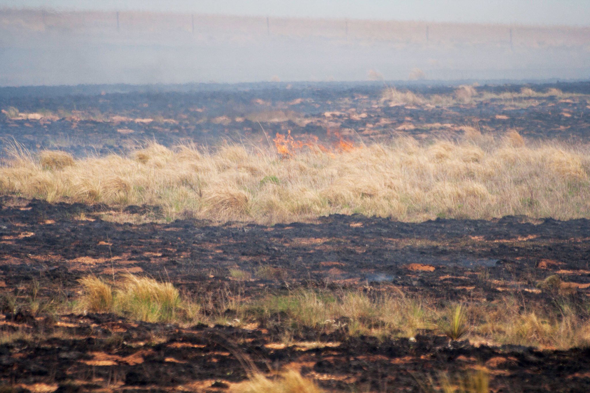
Prescribed burns, such as the one shown here on the Gray/Wheeler county line, are an important tool for managing conservation lands. Christopher Collins
The Farm Service Agency (FSA), the USDA branch that oversees the conservation program, estimates that 10,000 acres of land enrolled in the program were burned in the wildfires this spring. Each CRP contract is slightly different because agreements are tailored to specific geographical areas, but most include a provision of “mid-contract management” that details how brush is to be controlled. Mowing, grazing and prescribed burning are sometimes options.
But there’s some doubt that FSA has held landowners accountable. In 2014, the USDA’s inspector general blasted the FSA for failing to ensure that participants in the CRP and other farm programs were following rules. The scathing report came on the heels of the 2014 Farm Bill, which slashed FSA’s budget by $170 million. That law further hobbled the agency’s ability to do compliance reviews.
Mark Elmore, a wheat farmer near Allison in Wheeler County, owned CRP land with his father in the 2000s, he said. When the land became overgrown, the local USDA office would sometimes send letters asking them to cut it, but the agency never followed up, he said. “Oh, they sent notices, because you’re required to keep the brush and trees managed. But it wasn’t enforced — they just sent it out. So they covered themselves,” Elmore said.
Tommye Cole, who operates a fertilizer and seed business in the area, also mows CRP grass and bales it as hay when farmers ask him to. But because of pervasive mesquite trees, plum thickets and other brush, cutting the grass is difficult. “If it’s grown for 10 years out there, when you move in there with your swathers, you’re getting a tremendous amount of brush and a lot of stuff that’s real hard on your equipment,” he said. “Where have the employees at the USDA been for the last 30 years? Why haven’t they been able to see that it’s grown up?”
An FSA spokesperson, who asked not to be named but refused to explain why, said the agency does not routinely inspect CRP land. Spot checks are conducted with the help of the Natural Resources Conservation Service, another USDA agency, though “ultimately it is the responsibility of the CRP contract holder to comply with the terms and conditions of the contract,” the spokesperson said.
According to the Environmental Working Group, a nonprofit that tracks farm subsidies, landowners in Wheeler County have been paid $25.4 million from 1995 to 2014 through the CRP. In the same time period, a miniscule amount in fines has been levied on landowners who have violated contracts: about $172,000 for unapproved haying and grazing and about $7,000 for contract noncompliance, which could include failure to manage brush. Documents obtained from the FSA by the Observer show that the most common type of infraction committed by CRP landowners statewide from 2014 to 2016 involved the unapproved removal of conservation grass, either by grazing, mowing or tilling the land to plant commodity crops. Some violators were forced to pay back subsidies, though contract terminations were rare, data shows. In that time period, only two CRP contracts were terminated for grass removal. Another was terminated for failure to manage brush, among other reasons.
“It’s been my experience with CRP land that it’s set aside and devoted to CRP but then no management after that occurs, or very little management,” said Morgan Russell, assistant professor and range specialist at the Texas A&M AgriLife Extension Service. “You get this massive fuel accumulation, and in the long term, it turns into a tinderbox waiting to ignite, especially when we have major wildfire conditions.”
Russell, who studies rangeland ecology, land management and fire return intervals, said the debate between fire safety and conservation is a nuanced one. “As an ecologist, I feel kind of torn on CRP land. I’m glad it’s being taken out of the till system — the intensive farming system — but on the other hand, you can’t just walk away from it and leave it alone,” Russell said.
“The true irony is that the CRP was a contributing factor in the wildfires, and only after the fires do they turn it loose for grazing. That’s kind of like shutting the barn door after all the cows have gotten out.”
Wheeler County Judge Jerry Dan Hefley, cousin of the firefighter Hefley, also acknowledged the dichotomy, calling it a “double-edged sword.” He noted that during the 2011 drought, one of the worst in state history, the USDA gave the go-ahead to ranchers who wanted to graze their starving cattle on CRP land. “We definitely got to keep a few cattle because of lovegrass,” Hefley said, referring to the bunchgrass imported to the United States from East Africa that is sometimes planted on CRP land in Wheeler County. “And it keeps us from blowing away, too, in a drought.”
At the same time, overgrown CRP plots may be putting Wheeler and other nearby communities in the path of the next big wildfire. “If [the USDA] would let us control it just around the edges of towns, it’d be really good,” he said. “Here in town, we’ve got CRP right up against us. If they’d let us burn it back, it’d make the town safer.”
During the March fires, a Wheeler County employee was using a road grader to cut a fire break when the blaze swept across him, killing the vehicle’s engine, imploding the glass windows and burning the man so badly that he was taken by helicopter to a burn center in Lubbock. In late April, he was still hospitalized. “When [CRP] land grows up in such a mat, those wildfires can just go so far and keep traveling. It would be real nice to have a fire break every once in a while,” Hefley said. “Now the question is: Do we send out the road graders or not send them out? In my mind, we can’t afford not to.”
Hefley associates the growth of the CRP program in Wheeler County from the late 1980s through the 2000s with a literal reshaping of the area’s landscape. In that time period, some fields were taken out of cultivation and put into the conservation program, making them more fire-prone. “When we had more wheat fields and cotton fields, you could have a pretty good fire and it just wouldn’t go that far. It just had nowhere to go,” he said. “Now those things can go for miles and miles.”
Historical land-usage data compiled by the USDA appears to bear that out. In 1954, Wheeler County reported 133,200 acres of harvested cropland. By 2012, the county had only 43,300 acres of harvested cropland, and almost as much — 32,100 acres — enrolled in government conservation programs. Farmers often have a strong financial incentive to put their land in the CRP: The program’s payments are stable, while crop prices are not. An analysis by the Environmental Working Group found that many farmers switch between the two markets. “Farmers will take advantage of the CRP’s revolving door to put land in or pull it out of the program, with taxpayers picking up the tab,” said Anne Weir Schechinger, one of the report’s authors, in a press release.

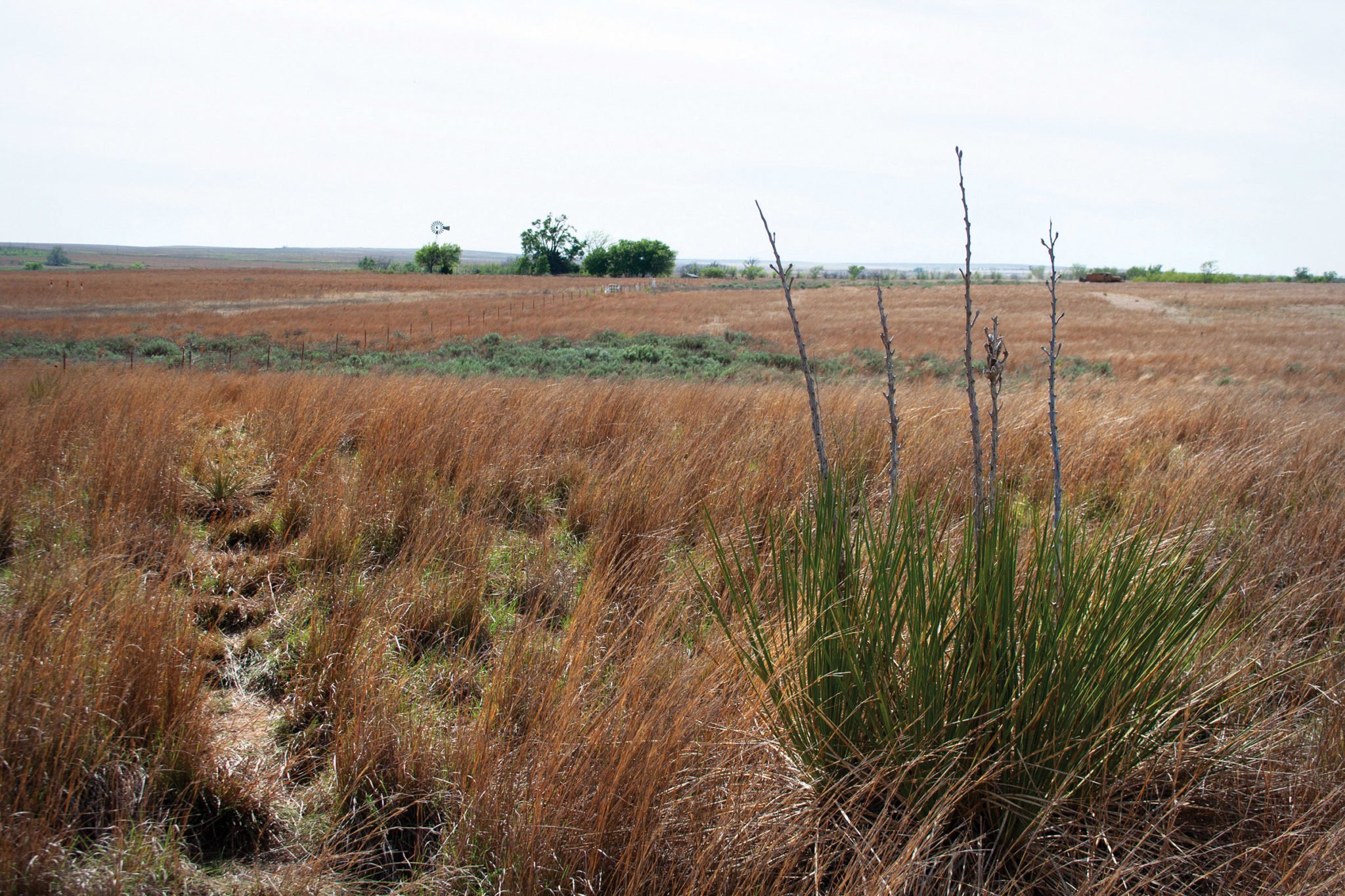
When conservation lands aren’t properly managed, brush and trees proliferate and can provide fuel for wildfires. Christopher Collins
Little research has been done on the relationship between CRP land and fire danger. One of the few studies, a conference paper authored by National Weather Service meteorologist Todd Lindley, found a correlation between conservation programs and fire danger. “What you get is this turn back to the natural landscape, which was historically a landscape where fire was very prevalent,” Lindley told the Observer.
The study points to a massive wildfire that tore through the town of Cross Plains, just east of Abilene, in December 2005. The fire killed two people and leveled 120 homes, churches and businesses. Just as in Wheeler County, the land surrounding Cross Plains in Callahan County had shifted away from harvested cropland to CRP enrollment. Lindley and his fellow researchers are credited with identifying the conditions that create multiple, near-simultaneous fires in Plains states, a phenomenon they’ve coined as “Southern Great Plains wildfire outbreaks.”
Bob Kirkham, 79, had just retired to Cross Plains from a job as a mine safety engineer when the fire struck. “The fire would hit a house and it’d be like, ‘Poof!’” Kirkham said. “And those trees were the same way. Them oak trees just looked like sparklers. All that stuff would just fly to different places and start new fires.”
As in Wheeler County, Callahan County’s agricultural landscape has been at least partially shaped by government programs. Though cattle ranching has always been the primary agricultural pursuit in the county, grains, vegetables and legumes have also been part of the portfolio. Unlike the ranchers, however, area farmers appeared to be at the mercy of government price controls — the county had a booming peanut industry until the 1940s, when federally mandated acreage allotments forced production farther west, said Kirkham, who grew up on a peanut farm 2 miles west of town.
“My dad was a peanut farmer. That’s all we raised,” he said. Mostly blocked from growing peanuts, Callahan County farmers switched to cultivating castor beans, refined to make castor oil, for the U.S. war effort in Korea. Castor bean production ceased after the war ended in the early 1950s. Also in the ’50s, an extended drought hindered farming in Callahan County, causing some farmers to leave the area and others to turn to ranching. When the CRP became an option in 1985, some landowners signed up. In 2002, three years before the Cross Plains fire, CRP enrollment in the county peaked at about 8,000 acres, while the number of harvested cropland acres sunk to a historic low.
In the months leading up to the fire, Kirkham said, the countryside was “so thick with brush you couldn’t even walk through it. A lot of it was mesquite, oak. That ol’ grass will grow up waist-high in that field.” He paused. “Kind of like how it is right now.”
